Explore Dauphin
Use the interactive map below to find points of interest. You can zoom in, move around or use the listings on the left.
MAPS
Need a map? Download one of our tourism maps and make sure you see everything Dauphin has to offer.
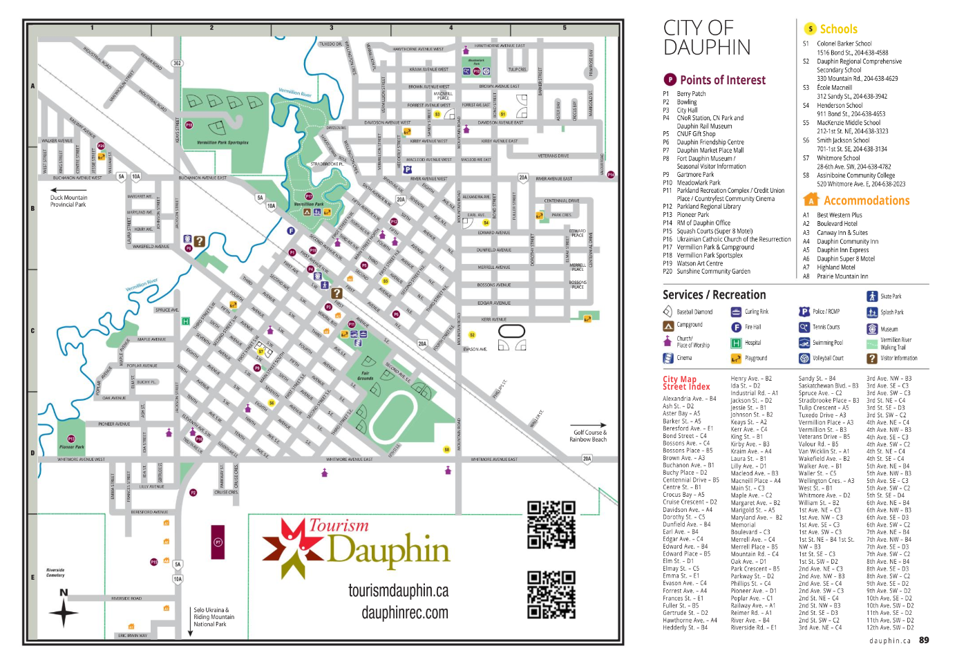
City of Dauphin Tourism Map
Download a PDF version of our City of Dauphin Tourism Map.
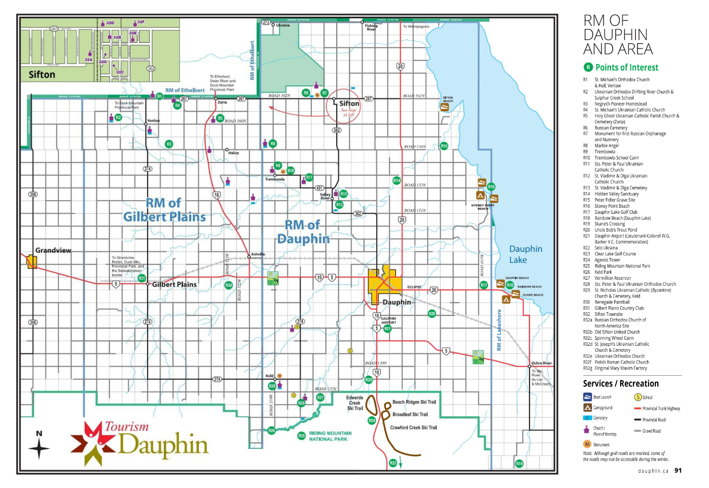
Dauphin RM Tourism Map
Download a PDF version of our Dauphin RM Tourism Map.
Morning
Start the day downtown Dauphin. Head to Western Bakery for some seasonal fresh dill buns, perogy bread, or some famous ooey gooey sticky buns!
Stop in at Trocadero and get a hot (or cold) cup of java from Trocadero to pair with your sticky buns for breakfast!
Afternoon
Learn about Dauphin's history by taking a self-guided Historical Walking Tour. Pick up the walking tour map features some straightaways and spurs – set your route, do it all at once, or break it up!
After working up an appetite you can stop in at Showdra Meats and stock up on the famous locally produced kubasa and dill pepperoni.
Evening
Check out Canada’s National Ukrainian Festival Gift Shop and drop in at The Prairie Corner to browse a wide selection quirky Ukrainian-themed treasures and gifts.
For supper you can order a Spicy Perogy pizza or conquer the Perogy Palooza from Corrina’s on Main Family Dining, topped with fried onions and served with kolbasa, sauerkraut, and sour cream!
Dauphin by Car
There are various routes to get to Dauphin. Please use Google Maps to determine which route is best for you.
Always remember to check driving conditions before travelling here.

Car Rental & Taxis
Car Rental
U-Drive Car Rental - 1-888-270-6804
Taxis
Dauphin Taxi - 204-638-3315
Dauphin Handi Van - 204-638-8884
Prairie Road Shuttle - 1-431-345-0314
RJ Taxi & Shuttles - 204-647-9888
Dauphin Shuttle Man - 431-738-1958

Via Rail
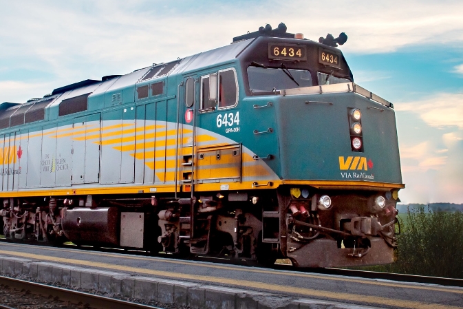
Via Rail offers an inexpensive and unique travelling experience for those with a little more time to explore! VIA gives mountain bikers the chance to bring collapsible bikes and camping gear for little to no charge and ride the multitude of trails in beautiful Riding Mountain, which offers some of the best terrain east of the Rockies.
Visit ViaRail.ca today to plan your trip.
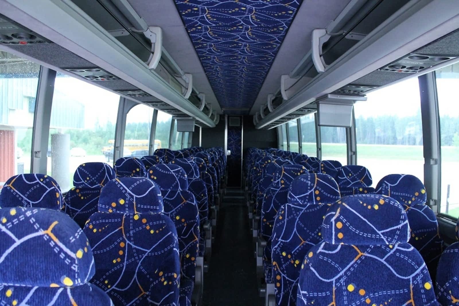
Bus
Dawson Logistics Maple Bus Lines
For more information on routes and schedules, visit maplebuslines.com or call 204-638-7169
Mahihkan Bus Lines
White Dove Water Company & Laundromat is our local Mahihkan Bus Lines agent.
For more information on routes and schedules, visit mahihkanbuslines.com, call 204-629-2837 or email dauphin@mahihkanbuslines.com
Air
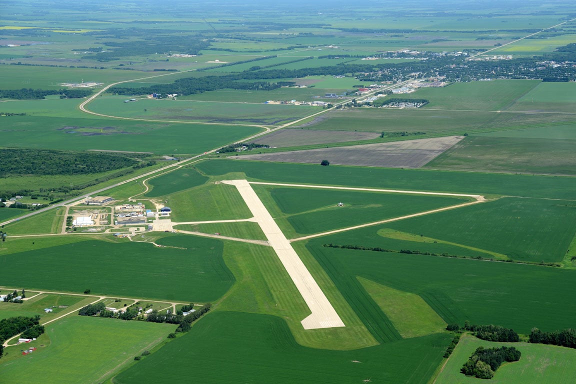
Lt. Col W.G. (Billy) Barker VC Airport
Lt. Col W.G. (Billy) Barker, VC Airport or Dauphin Airport, formerly the Dauphin Regional Airport, is located 3 miles south of Dauphin. It is named after the top Canadian fighter ace in WW I, Dauphin resident William George Barker.
The airport was originally established as RCAF Station Dauphin as part of the British Commonwealth Air Training Plan.
Air Services
The airport is home to a small fleet of private airplanes, a destination for air ambulance flights for the Parkland region and seasonal overnight station for water bombers and helicopters.
Our local taxi service provides ground transportation to and from the airport.
Brandon Flight Centre - satellite training location
Did you know that you can train to get your pilot license right here in Dauphin?Brandon Flight Centre operates a satellite school from the Dauphin airport which started in August 2021. Since 1936 BFC has trained pilots, maintained and fueled aircrafts and assisted the local aviation community. Thousands of pilots have passed through their doors and gone on to service in Canada’s military or civil aviation. Their team of professional experts are here and ready to assist you with any of your aviation needs. For more information visit www.brandonflightcentre.com
Airport flight information
The airport has 3 runways, 14/32 is the main asphalt runway and is 150’ wide and 5003’ in length. A second asphalt cross wind runway 08/26 that is 75’ wide and 2703’ feet in length, finally a third gravel crosswind runway that is 60’ wide and 2110’ in length.
The main runway 14/32 is equipped with ODAL’s (omni directional approach lighting) and PAPI’s (precision approach path indicator. Elevation is 999” and geographical position is N51 06 05 W100 03 12 3S 6°E, 122.3 MHz is the Major frequency, and 128.6 MHz is the AWOS (automated weather observation system) operated by NavCanada. The frequency is manned by Brandon Radio Services (NavCanada) Monday – Friday from 6AM- 8PM daily, outside of those hours it is self-broadcast. The runway lights are RCAL (remotely) controlled by way of 122.3 MHz radio frequency.
The fuel system is a self-serve 24hour card lock that accepts Visa or MasterCard and there are 2 fuel types: 100LL (low lead) and Jet A-1.
About Dauphin Tourism
The Tourism Dauphin office is a joint effort between City of Dauphin and Rural Municipality of Dauphin and the unified voice for tourism in the region.
We are the most trusted source of accurate information for any travelers visiting the area. Stop by the office at 100 Main Street South or use the form and we would be happy to help you!
